GyroTrack
 Prime Horizontal now offers post-installation pipeline surveying using gyroscope technology. With unrivalled customer service, fast reaction times, a flexible approach to client requirements and offices on four continents, Prime Horizontal now offers GyroTrack service worldwide using the field proven GyroTrack platform. Companies may use GyroTrack for mapping their product lines after using Prime Horizontal for the initial HDD services or they can use GyroTrack to map their existing pipeline and utility lines.
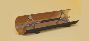
GyroTrack is a versatile and unique multi-purpose pipeline mapping system. With a proven track record on virtually every continent, this multi-diameter system provides the most accurate results on pipeline location. A unique system of exchangeable centralizing wheel units gives the GyroTrack an operational range of ID 90 mm (3.5″) to ID 1200 (48″). Whether the pipeline is made of steel, concrete, HDPE or PVC, this mapping system will improve any HDD implementation procedure.
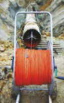
The GyroTrack tool with centralization, may be pulled either by a hand operated wireline or a mechanical winch. In certain cases, the tool may be pumped through the product line.
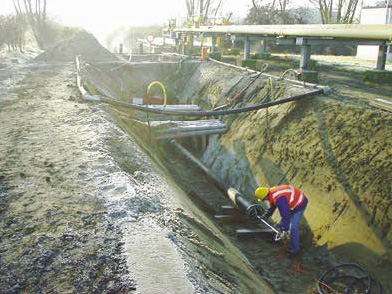
 After physical location measurements are made with the HDD operation, the GyroTrack tool is inserted into one end of the product line. GyroTrack is pulled through the line at a predetermined rate, usually 1 m/sec to 1.5 m/sec. After GyroTrack arrives at the other end of the product line, it is reversed and pulled back obtaining a second, confirming, set of data. The captured data is immediately checked on site to ensure data collection limits and quality control targets have been met. After confirmation, the data may be uploaded to the office through GPRS or an immediate, on site Survey Report may be provided or both. The on-site report includes at least the following attributes:

- D pipeline profile
- Bend radius report per customer defined intervals
- Inclination analysis
- Job specification
- Job locations
Output data can be exported to open platform formats for seamless integration into common, industry-standard GIS formats and saved to files such as AutoCAD, Excel, MicroStation and Notepad.
GyroTrack Operating Specifications
** Accuracies subject to many environmental factors and are more closely defined within each Post Job Report. Specifications may change without prior notice.


